
Transport Futures East Sussex (TFES) is the name we agreed upon after our long standing relationship with Campaign for Better Transport ended. What hasn’t changed is our commitment to promoting sustainable, healthy transport, integrated with planning practices that deliver healthy, beautiful living spaces – not ones dominated or degraded – or made unsafe by traffic.
Developing sustainable transport choices must be at the core of the county’s Local Transport Plan (LTP) development. The current plan (LTP3) is being reviewed prior to work on LTP4 but compared to the heady days of LTP1 1999/2000 when workshops were held around the county and contributions from the public were welcomed, the feeling now is of distance from those making very important decisions that will determine the quality of life of current and future generations in our still beautiful and varied county’s rural and urban spaces.
East Sussex County Council (ESCC) – and Transport for the South East (TFSE) – are still pursuing major road expansion while claiming to adhere to sustainability criteria. And despite warnings from the Science and Technology (Select) Committee that we must avoid simply exchanging petrol and diesel vehicles for electric ones, lest we replicate existing congestion/consumption/urban sprawl/unhealthy lifestyle/environmental problems, we hear little mention of that principle and see everyday examples of a lack of integration of transport and land use policies as unsustainable developments proceed apace.
EASTBOURNE DEMONSTRATION IN SUPPORT OF STRONG COP 26 MEASURES
In Eastbourne, on a blustery November 6th, an estimated 450 people of all ages gathered at ‘Bankers Corner’ in the town centre for a protest march in response to sluggish progress on necessary measures to address our climate and biodiversity crisis: photos below:
Speeches, music and poetry followed on the Wish Tower slopes
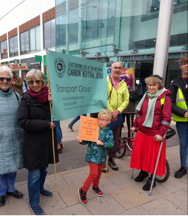
EEAN with junior supporter 
COP26 Scenes 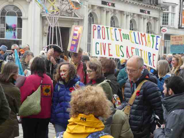
Some of the 400 plus demonstrators
PRE COVID PROMISE AND POST COVID HOPES –
BUS BACK BETTER: BUS SERVICE IMPROVEMENT PLAN (BSIP)
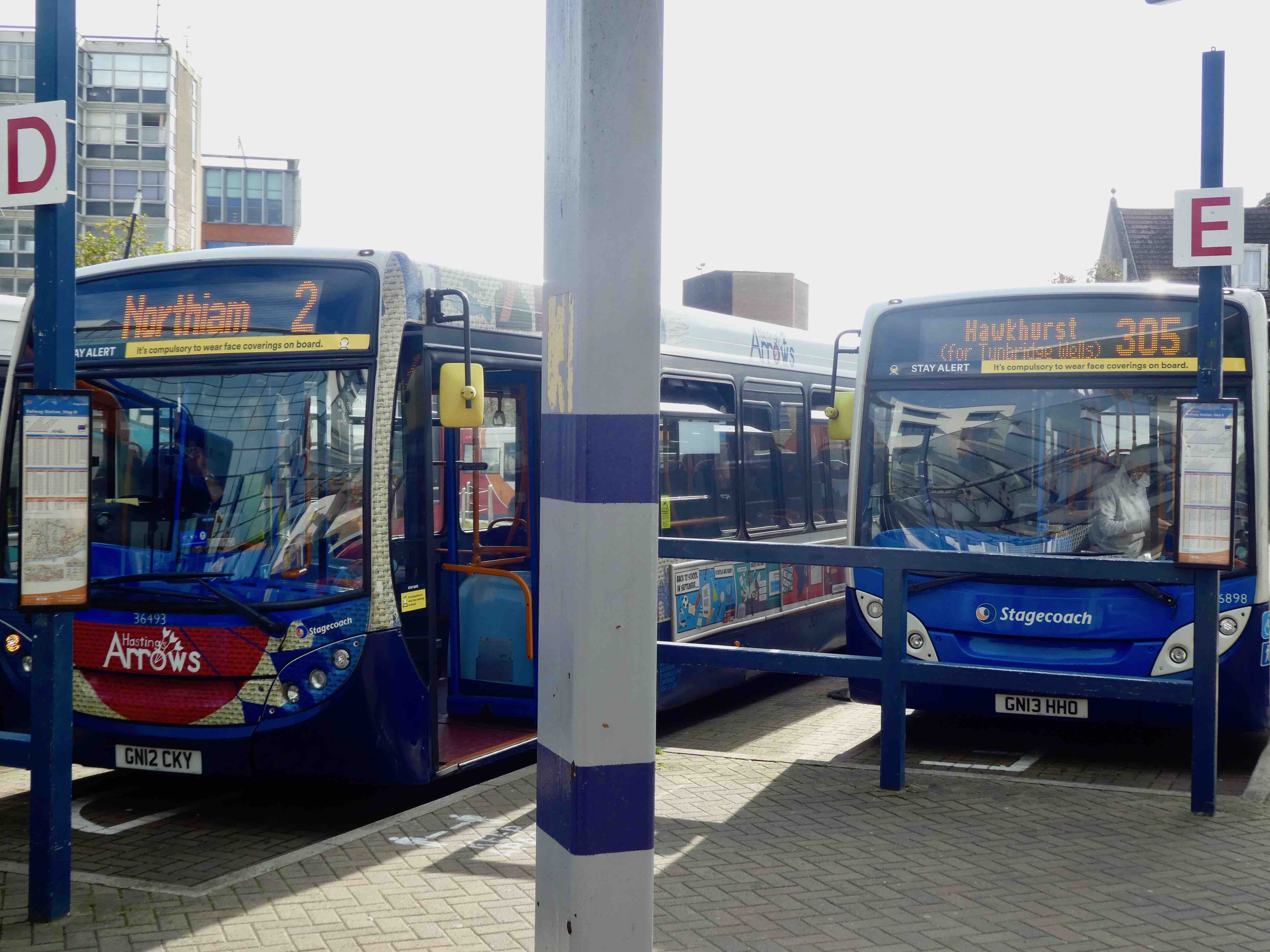
Pictured below at Hastings Station, two services destined for improvement via a grant of £265,000 from the Department for Transport (DfT) in April 2020. Now the wider BSIP – potentially attracting a share of the £3bn of government funding – is being considered by East Sussex County Council prior to submission to the DfT: deadline – 31st October*. All of England’s Transport Authorities are going through this process. Consultants have been engaged to work jointly with ESCC and WSCC to plan improvements to existing services and potential new services. Importantly, a BSIP will also consider bus priority measures as a means to improve punctuality and to speed up services. There is also a commitment to make fares more affordable.Transport Futures East Sussex has considered some possibilities and submitted these to ESCC. (See below). Also below, the bus must play a bigger part in our daily lives as part of the battle against climate change and bodiversity loss, whether for commuting, or for leisure. * see the bid content below
BSIP – OUR IDEAS
We submitted ideas for the plan some time ago and these are summarised in the links below:
Member Brian Phillips also added valuable comments in a supplementary document here:
ESCC Bus Service Improvement Plan Bid here:
And our initial comments:
LOSS OF RURAL BUS/RAILCONNECTION IN HIGH WEALD AREA OF OUTSTANDING NATURAL BEAUTY?
The Compass Travel 231 bus serves Uckfield – Framfield – Heathfield – Broad Oak – Burwash – Etchingham – with a very limited extension to Hurst Green. Historically, it ran through to Hawkhurst, just over the Kent border.
The service linked rural communities at each end, with rail services to/from Uckfield and Etchingham, and the National Trust property at Bateman’s (Kipling’s home) at Burwash, with annual visitor numbers of 122,823 (National Trust Annual Report, 2019/20). The proposals in the East Sussex County Council BSIP bid to the DfT are for the timetabled sevice to start/end at Heathfield. East of Heathfield, ‘Digital Demand Responsive Transport’ (DDRT) will be offered. We think this is an unnecessary downgrade of a service never marketed within the AONB, despite its potential to serve local people and also the tourism economy.
Bateman’s report that there are many enquiries from potential visitors on the availability of bus access connecting with trains at Etchingham station. Buses currently leave Etchingham station two-hourly and pass Bateman’s Lane, requiring a short walk to the property. However, there are no buses at all on weekends and Bank Holidays, typically the busiest times for visitors. Consequently, very few people visit by public transport, and there is traffic pressure on unsuitable lanes – an unfortunately general characteristic of the AONB. Kent County Council’s consultation responses included requests for a link to Etchingham station
In the ESCC bid, two nearby core bus routes are envisaged for expansion, seven days a week: the Stagecoach 51 (Eastbourne – Hailsham – Heathfield – Tunbridge Wells), and the Stagecoach 304/5 (Hastings – Battle – Robertsbridge – Hurst Green – Hawkhurst – Wadhurst – Tunbridge Wells). Ideally, the 231 would be extended 7 days a week to Hawkhurst, giving a connection to Bodiam Castle via Stagecoach 349, and with an Arriva 5 service to Cranbrook and Maidstone.
The Dudwell valley (Bateman’s) and the East Rother Valley (Bodiam Castle and KESR steam railway) offer relatively remote countryside with endless opportunities to enjoy walks in the AONB. Public transport could play a much bigger role here.
We are suprised to note the absence of any voice of the AONB authority in the BSIP consultation process.
We will contact ESCC suggesting these corrections which would serve the objectives of the ESCC ‘Tourism Recovery Plan’
THE BUS – AS A MESSAGE – AND AS AN IMPORTANT PART OF THE TOURIST ECONOMY, OFTEN UNDERSOLD


Cuckmere Community Buses also give access to the eastern part of the South Downs Natiuonal Park and offer rail connectuions at Berwick Station.
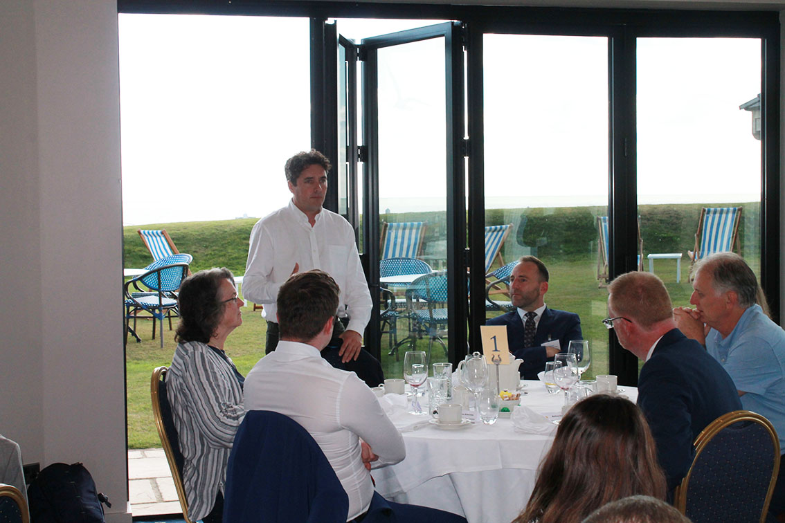
STAGECOACH SOUTH EAST – COODEN EVENT WITH CYCLING MP!
Stagecoach invited MPs, Councillors, NHS representative, Chambers of Commerce members and other guests to the presentation to underline their commitment to ‘excellence’ on bus services and to express their hopes for good outcomes from the Bus Service Improvenment Plans (BSIP). Here is their summary of intent:
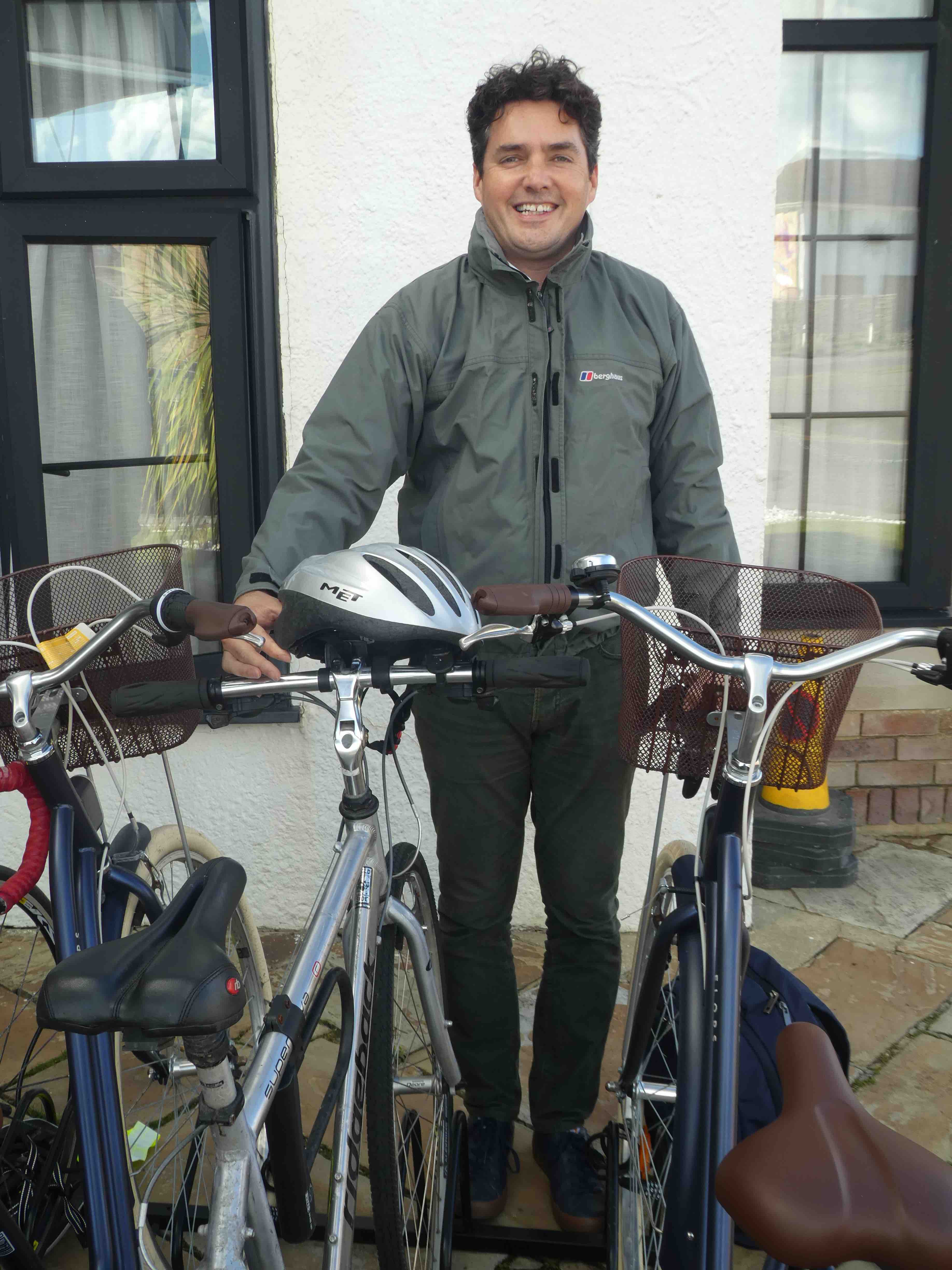
Stagecoach South East MD Joel Mitchell gave an upbeat account of the company’s aims to provide an expanded service ‘carrying many more passengers more cheaply’ in the new ‘Bus Back Better’ environment, delivering quality of life and carbon reduction goals. He also paid tribute to the staff and their hard work in a very difficult period for the industry. Huw Merriman MP for Bexhill and Battle (includes Pevensey, borders Stone Cross and also rural Etchingham, Robertsbridge and Burwash), and is also Chair of the parliamentary ‘ Transport Select Committee, also addressed the gathering, predicting a bigger role for buses in meeting the needs of the public and businesses – and meeting carbon reduction targets via an ambitious BSIP plan.
The MP also recognised the crucial ‘front line’ role of the drivers in keeping services running throughout the Covid crisis. In the pre-lunch networking session I was able to speak with Huw Merriman about our ideas for BSIP and also the Public Inquiry into the restoration of a rail link between Robertsbridge and Bodiam in which we had both given evidence in support. I also briefly mentioned the Transport for New Homes principles of integrating ‘transport’ and ‘planning’ . The Select Committee had hosted the launch of TFNH in 2019.
MID NOVEMBER SURPRISE AT EASTBOURNE STATION!
A ‘real time’ display has appeared at Eastbourne Railway Station in a usefully conspicuous position. Hopefully, the screens will appear more widely – and may already have done so. We’ve waited years for these: they are very welcome and can only raise the status and use of the bus.
One downside: the buses to the east and some to the north of the town don’t appear (1X,98,99, LOOP) and their bus stop locations (Cornfield Road) are not on the map although these are only 4-5 minutes walk away.There is room just to the left of the new display.
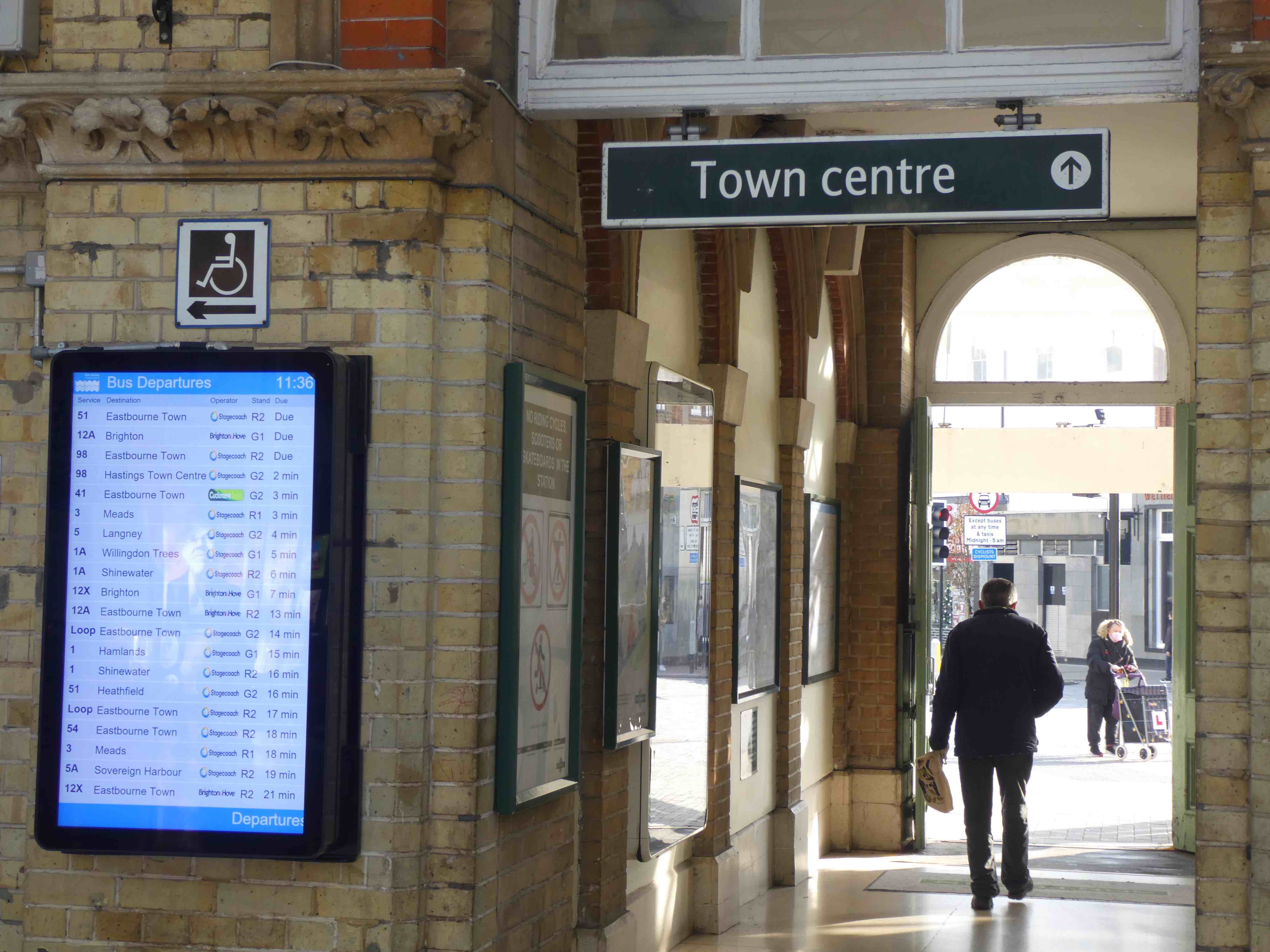

Bus stops near station 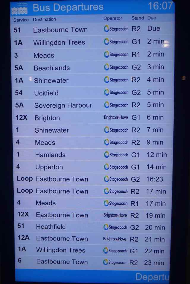
Destinations/Departure times
LEWES NEWS FROM ‘TRAVELOG’ HERE (including bus info and much more from Chris Smith):
ESCC – EXPANDING ROUNDABOUT CAPACITY IN THE EASTBOURNE/HAILSHAM AREA – A22/2290
A six week consultation was launched in July on proposals to increase the capacity of roundabouts on the above routes. Following housing developments in recent years, these routes are already under pressure at peak (and other) times, leading to congestion. This is is exacerbated by missed opportunities over decades to set in place traffic resytraint measures and high quality public transport provision – bus and rail ahead of developments. Further developments are planned in Eastbourne but mainly for Wealden District. However, the area could accurately be described as ‘Greater Eastbourne’ which, for some Wealden councillors, is unpalatable. This antipathy towards the concept and a lack of much needed collaboration, has resulted in poor integration of ‘transport’ and ‘planning’. All residents therefore suffer from too much traffic and reduced quality of life. By definition, children are the main losers.
With much more residential development to come, there’s an element of ‘predict and provide’ about the planned increases in road space and we have questioned that widely discredited approach – especially as development of alternative, sustainable modes of transport – walking, cycling, bus, rail – are provided not as integral to any development, but bolted on later if at all, and delivered sluggishly, long after the car habit has been established and perpetuated. Expansion of the role for rail is barely discussed.
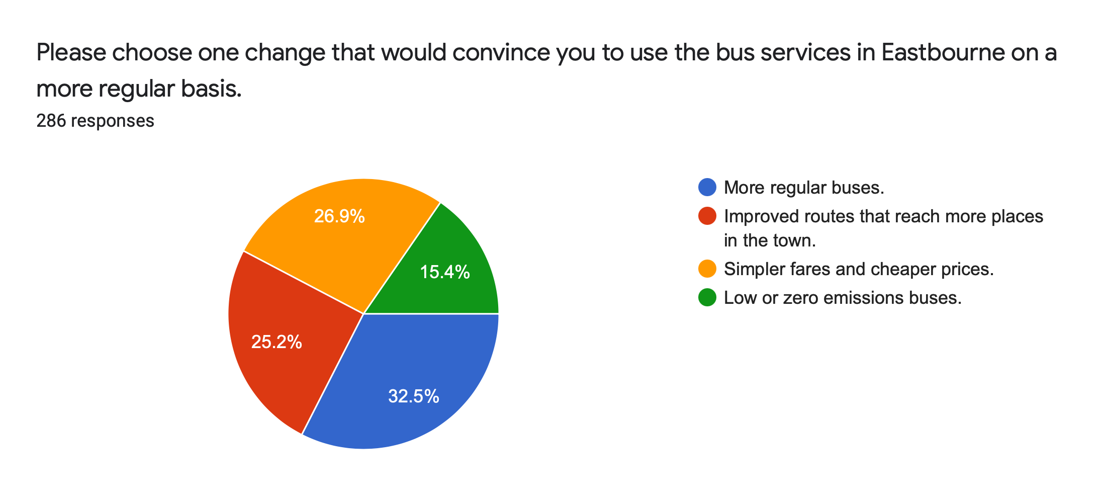
In our submission as part of the consultation, we queried the absence of ‘origin/destination’ data that should have informed the plans, hoping that this would be revealed. The reply from ESCC confirms that data was obtained, showing the nature of trips, and telling us that it can be provided. We have now asked for this in a clear form such as a ‘pie chart’ that might be expected in a ‘non-technical summary’.
See below links to the consultation document, response from TFES and a reply from ESCC:
Consultation Document: East Sussex Consultation Hub
Response from TFES:
And, Reply from ESCC:
You’ll see from ESCC’s further response to our data request (below) that they have provided a bar chart showing the proportions of trips by distance on the A22 but not the ‘pie chart’ format which would show with some precision the origins and destinations of trips. From that we (the lay audience) might discern what measures might better deliver sustainable outcomes – and where these might be provided. Below is the ESCC ‘bar chart’ letter, and to illustrate what we mean, we also show an ‘origin/destination’ pie chart produced for the A27 east of Lewes for the 2002 South Coast Multi-Modal Study (SoCoMMS). A similar pie chart for the A22 would bring clarity and we’ll be asking for that.
SoCoMMS and the guidance for all multi-modal studies (GOMMS) was I believe a model for all the MMS of the early 2000s.
It advised that for any scheme, a non-technical summary should be published so as to make the rationale for any scheme accessible to a wide public audience to achieve as great as possible engagement with consultations. These summaries don’t seem to be as common a feature as in those days and face to face meetings were already rarer even before Covid. Funding and staff cuts may be to blame as the austerity years have taken their toll and such necessities as public engagement have diminished. Anyway, long live the pie chart.
A pie chart (see below) would show the data provided but with geographical detail. The same would be true for the A27 for sections between Arundel and Pevensey.

NEW A27? – A BILLION POUND ‘NATIONAL HIGHWAYS‘ ROUTE TO OVER DEVELOPMENT AND CAR DEPENDENCY IN LEWES, WEALDEN AND EASTBOURNE!
History tells us that regardless of the weakness of the case for a big transport scheme (usually roads), a nod from a minister concerning a project where the sitting MP is in a marginal constituency is all it takes for construction to begin. The Bexhill to Hastings Link Road (£24m rising to £130m) got the go-ahead despite being the worst value for money scheme in a contemporary list of 21 schemes and having the second worst predicted CO2 emissions.
The business case for the A27 mega-highway is very flimsy indeed and breaks rules governing preparation, while so many potential measures in the realm of transport and planning that could better deliver objectives claimed for the outdated road scheme have not been investigated, or have been ignored.
The mega A27 project is also linked to future patterns of urban development and could lead us towrads even greater car dependency for trips of all lengths. Professor Phil Goodwin (emeritus professor of transport policy at both the Centre for Transport and Society, University of the West of England, Bristol, and University College London) writes:
‘In all these cases (travel behaviours in conurbations, cities and smaller towns – my italics), what happens in urban areas will interact with the travel between them, so that there will be effects on interurban traffic flows also – motorways are often located in the countryside, but the traffic on them is mostly not rural, it is generated by urban activity patterns. If the urban targets imply, and require, a prolonged reduction in car use, they will also have effects on car ownership, and effects on journey lengths. That implies also a potentially very different pattern of future traffic than has been assumed in the project appraisals based on indefinitely prolonged car traffic growth. Policies have repercussions, and they must also be considered’.
A city with higher mode share of sustainable transport useage (say Brighton and Hove) will, according to the author, generate fewer car trips of all lengths. A smaller urban area with a lower mode share (say Eastbourne, Hailsham, Polegate) will continue generating higher numbers of car trips of all lengths until such time as measures are introduced to ‘turn the tide’ and ‘car dependent developments cease. That is made much more difficult if the developments race ahead without the planned sustainable transport measures determining the nature of the development.
The statistical map below shows that the performance of Brighton and Hove in successfully creating conditions for higher take-up pf sustainable modes (walking, cycling, bus, rail) contrasts with the situation in Eastbourne/Hailsham/Polegate. (paradoxically, the deeper reds indicate high mode share of sustainable modes and the deeper greens low take-up!) A conclusion may be that Brighton’s performance success could be even higher if it wasn’t undermined by the Eastbourne/Hailsham/Polegate area’s lack of progress in introduction of sustainable transport choices and measures to support these. A new A27 would not be compatible with key environmental and social equity objectives and would undermine these over a large area of East Sussex and Brighton/Hove.
Surely, the lesson is: don’t WASTE £1BN on the outdated A27 superhighway project: INVEST in the whole range of sustainable transport measures AVAILABLE along with a BAN on the current procession of car dependent residential developments.

TRANSPORT FOR THE SOUTH EAST – SUBMISSION TO THE GOVERNMENT’S COMPREHENSIVE SPENDING REVIEW
We were momentarily pleased to see on page 4 that there’s an apparent rejection of a ‘predict and provide’ approach to transport planning. Sadly, we then reflect on TFSE’s pursuit of the massive damaging and irrelevant A27 superhighway project. Exploratory digging has already begun at Arundel despite the scheme’s lack of any government approval. It looks like a ‘just one more road scheme, then we’ll consider alternatives’ approach.
With a 30 year strategy aspiring to reflect a ‘people and place based approach to future mobility’, the submission claims that ‘transport technologies of the future will make more journeys faster, easier, safer, greener, comfortable and more affordable’. (page 5). A ‘Projectview’ data tool, it is explained, ‘brings together in one place a wide range of land use planning and transport planning data’. This will ‘be used across all Local Transport Authorities (LTAs) and District and Borough authorities’ and, share ‘best practice with Local Authority officers’.
It seems then that all the pieces in the jigsaw are on the table – ‘transport planning’, ‘land use planning’, LTAs together with District and Borough planning authorities sharing ‘best practice’. But any ‘conference’ of these bodies considering the transport and planning concepts should also be honest enough to examine the ‘bad practice’ where (as TFSE officers have agreed) residential developments are completed and occupied ahead of bus services, by which time the car habit is well established making conditions unpleasant or dangerous for pedestrians and cyclists. If there is any scrutiny of travel plans associated with new devekopments, all too often there’s no evidence that any action has been taken to secure the necessary infrastructure for sustainable transport.
The Centre for Research into Energy Demand Solutions (CREDS) have helped TFSE develop a useful tool to measure, at neighbourhood level, carbon footprint. CREDS, along with the Science and Technology Committee, have emphasised the importance of ‘behaviour change’ in delivering carbon reduction and it’s there that the biggest challenges lie. We think that TFSE should be explicit on that requirement: technology is just one component in the battle to combat climate change and simply exchanging petrol and diesel vehicles for electric ones will replicate almost all of the current problems attached to car dependency – and create more problems to be solved around resource consumption .
TFSE SUBMISSION HERE:
SWITCHING FROM ROAD TO RAIL – IS RAIL AN OPTION FOR PARCELS TRAFFIC?
In August, 2021, conversion of former Thameslink trains (class 319) from passenger to packet carriers had begun. Distribution company Orion intends to convert 19 of these 4 car units to operate on the national network (see network proposals here:
Orion – Rail Operations Groupfirst and last mile
https://orion.railopsgroup.co.uk
We note the national coverage proposed on the plan (Southampton being in the Transport for the South East – TFSE area) and have suggested to ESCC and TFSE that Brighton – possibly with Eastbourne and Hastings) could be added. If combined with ‘last mile delivery’ services by electric vcargo bikes, these trains could remove thousands of Light Goods Vehicles (LGVs – aka white vans) from our major roads and residential streets.
Encouragingly, Cycle delivery company Zedify of Brighton have expressed interest in this rail element of distribution and further developing their Brighton hub, while ESCC say, in their reply to our response to the A22/A2290 consultation that they ‘recognise the elements of first/last mile journeys’.
If rail could play a significant role in transporting packages currently delivered by LGVs then it could result in fewer van movements. Currently, these approach 5,000 per day on the A27. Of course, within our urban areas the number of ‘drops’ at individual addresses would amount to many more vehicle movements than this.
With railway stations quiet for some hours overnight, an electric cargo bike ‘last mile delivery’ would provide a far more sustainable method of distribution: current versions of threse bikes can carry up to one metric tonne and experience has shown that – with good cycle networks and ‘Low Traffic Neighbourhoods’ (LTNs) – they are reliable and efficient. Station car parks adjacent to stations could form part of distribution hubs.
The article from MODERN RAILWAYS (August 2021) can be seen here:
A259 STUDY – ROTTINGDEAN TO PEVENSEY
ESCC have engaged consultants WSP to investigate ways to improve ‘the efficiency and effectiveness’of the A259 corridor between Rottingdean and Pevensey through development of ‘a balanced package of multi-modal transport measures alongside integrating greater sustainable mobility options’. This is to complement the Transport for the South East (TFSE) ‘Outer Orbital Area Study’. WSP ran a workshop session on the 11th October to explore ideas and principles.
Attendees included representatives from Transport for the South East (TFSE – the regional non-statutory transport body for our region); South Downs Network, ESCC, District councillors, South Coast Alliance for Transport and Envirobnment – SCATE, ourselves – TFES, and one consultant for Seaford Town.
The study was to prepare an outline business case, a pipeline of projects to design and to explore channels for unclocking funding, over and above the £20 – £50m anticipated from government and to secure whatever funds developers might provide Objectives were ‘to reduce congestion, support the economy, delivery of housing, secure bebnefits for all road users and to ‘support’ the strategic road network’. A strong evidence base, value for money, consistency with local plans and strategies – all these should be present.
Various questions were raised and suggestions put forward such as:
A259 ‘corridor’ suggests it functions as such and implies lots of end to end movement. Is it not the case that there are many local movements, and measures should be tailored in line with more granular detail and local accessibility needs?
The number ‘259’ is misleading: maybe the road should have different numbers for different patches.
Exceat bridge widening would speed up and induce extra traffic in a beautiful part of the SDNP and should not go ahead. There wouldalso be a noise impact.
Everyone, including motorists, would be prepared to behave differently in order to conserve the special environment and minimise any negative traffic impact. Traffic restraint on the Cuckmere Valley lanes between Exceat – Alfristion – Berwick and Wilmington, coupled with similar treatment on Pevensey Levels/Normans Bay lanes would make family cycling/walking holidays based on Eastbourne/Seaford/ Newhaven an attractive option – including for ‘near continent’ visitors. Eastbourne has plenty of beds.
POLEGATE HIGH STREET: PEDESTRIAN CROSSINGS ON SIDE STREETS AND 20MPH LIMIT COULD TRANSFORM THE AREA
An alert about an ESCC consultation from Paul Humphreys of EEAN and BESPOKE – Eastbourne’s Cycling Group – gives hope to transform Polegate’s High Street and encourage walking. If adopted widely in the county, 20mph speed limits in town and residential streets could bring huge benefits for all – but especially for children. See below)
Please consider responding to the consultation. Paul’s alert is here:
And the push for easier delivery of Zebra crossings is explained here, along with the many advantages revealed by trials in Manchester. Let’s have these in all our residential areas and new developments.:
A SAFER ROUTE TO SCHOOL – LOCAL SURVEY IN TWO STREETS IN EASTBOURNE
Part of the journey to school for some infant/junior school children at St Thomas À Beckett and secondary students at Ratton Academy includes two relatively lightly trafficked streets – Mayfield Place and Gorringe Road. It is obviously considered by some parents and students to be an attractive and viable route – the numbers of individuals, including parents of the younger ones – suggest that. Informally at least, it is a ‘low traffic neighbourhood’. A conclusion could be that more routes to school with similar characteristics would induce higher levels of active travel and a reduction in school run traffic. The survey calculated 414 individual non car trips for the day. It was sent to East Sussex County Council ‘active travel’ team, making that point. The journey to and from school was evidently not just healthy, active travel, but an important social event!
CHILDRENS’ NEEDS EXCLUDED FROM TRANSPORT PLANNING.
‘Children are often excluded from transport planning which focusses more on commuting patterns of work related trips than on journeys to school’. The article here from Local Transport Today ( (LTT 826 June/July 2021) via the link calls for a radical re-think of transport planning that includes children.
SPATIAL PLANNING – TIME FOR SOME REBALANCING? ROOM FOR CAR CLUB VEHICLES?
Two opportunities exist in Commercial Road, Eastbourne, to expand green space by enlarging current islands of planting into existing road space, narrowing or closing the carriageway. Below are two examples but the principle could be applied in any urban setting. Closing off one ‘arm’ of the island could accomodate 2 or three spaces for ‘car club’ vehicles:

A more general point: if we are to deliver the objectives of the ‘Bus Service Improvement Plan’ and ‘Active Travel’ initiatives then we should be planning alternative uses for areas currently used for parking as demand decreases. The above examples would deliver benefits for health and nature – and closure of a ‘cut through’ next to Bourne junior school, to allow planting and providing air quality improvements and noise reduction for the children in the adjacent playground would also do just that. The image below shows the location:

Car clubs take away all the hassle of ownership: no worries over insurance, maintenance, parking, capital cost. and can lead to a willingness to try a mix of modes for different trips. They are a ‘pay as you go’ method which makes trips by car affordable to anyone with a licence in well maintained, clean vehicles.
ENDS with Best (almost seasonal) Wishes
